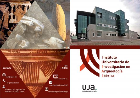
|
Artículos on-line |
CONQUEST AND ROMANIZATION OF THE UPPER VALLEY OF GUADALQUIVIR RIVER |
Marcelo Castro López
Luis
Gutiérrez Soler
This
study analyzes archaeological evidence for the romanization of the upper
Guadalquivir valley. This key region, which corresponds to the present-day
province of Jaén (Andalucía, Spain), straddled the boundaries of the Roman
provinces of Baetica and Tarraconensis. Our research attempts to
understand developments following the Roman conquest of this region, by focusing
upon two neighbouring territories. The results highlight apparent contradictions
and divergences in the archaeological record for the region as a whole (Castro
1993; Gutiérrez 1998). In particular, it analyzes the archaeological evidence
from the two contrasting oppida of Giribaile and Atalayuelas, of which
the former represents a break with earlier settlement patterns, while the latter
points to their continuation. It is suggested that these differences can be
explained by Rome’s adaptation of a particular strategy of domination and
exploitation to the distinctive conditions of the region, as well as by its
development of administrative policies through time (Castro 1989). Previous
research has already underlined the distinctive organization of the Sierra
Morena mining district, the occupation of new land in the San Juan river valley
(Castro et al. 1993), the foundation of colonies under Augustus and the
appearance of the first terra sigillata production centres (Roca 1976;
Sotomayor 1977; Fernández García, 1998). Such diversity in the techniques of
the economic exploitation of the region demands an overall historical framework
of interpretation to explain the romanization of the region between the Roman
conquest and the concession of ius latii to communities in the region by
the Emperor Vespasian (Pliny, N.H. III, 30), between AD 70 and 74 (according to
Segura, 1988; Cortijo 1993:201).
The
study area is situated in the modern province of Jaén, in upper Andalucía. It
has a distinctive topography on account of the river Guadalquivir which rises in
the Sierra de Cazorla in the east of the province. This has created the Great
Central, or Baetic, Depression which widens out as the river makes its way
westwards. In the upper reaches of the river, the landscape of the valley is
determined by the confluence of two very different morphogenetic units. To the
north, lies the Sierra Morena, which belongs to the underlying ancient massif of
the Iberian Peninsula, while to lay the newer relief of the Subbética range.
Both of these mountain ranges formed a depression, or central basin, within
which lay much of the agricultural resources of the upper Guadalquivir valley.
In
the centre of this basin stands "La Loma de Úbeda" (the Hillock of Úbeda),
which separates the course of the Guadalquivir from one of its main tributaries,
the Guadalimar. One of the survey projects which forms the subject of this paper,
that focusing upon the oppidum of Giribaile and the middle valley of the
river Guadalimar (Royo et al. 1995; Gutiérrez et al. 1995) lay in
this region. Between the Guadalquivir and the southern mountain rages (Subbética
range) in the western area of the upper valley, lay a flat area of cultivable
land, known as the Campiña de Jaén. This was the site of the second survey
project, which focused upon the Roman landscape around the settlement of
Atalayuelas.
RESEARCH
INTO THE ROMAN PERIOD
Archaeological
research in Jaén has concentrated upon the study of Iberian settlement patterns,
particularly those centred in the Campiña de Jaén. These have suggested that a
cereal economy was based on the existence of a network of oppida (Ruiz
Rodríguez and Molinos 1993), which articulated the control of political and
economic territories in the region. There is little doubt that the best-known
and most productive contribution in this field has been the systematic
excavation of the oppidum of Plaza de Armas de Puente Tablas (Ruiz Rodríguez
and Molinos 1987). With this model as a point of reference,
an alternative pattern of settlement has been proposed for the
easternmost area of Jaén province. This was centred upon an analysis of the
Guadalquivir basin, and revealed alignments of oppida following the
direction of the rivers.
Analyses of the landscape are our principal source of information about the process of romanization in the upper Gudalquivir valley. For some scholars, this represented a continuity of the Iberian pattern until at least the Republican period, to the point that the period between the end of the Second Punic War and the reign of Augustus has been labelled as the “late Iberian horizon” (Bendala 1981; Ruiz Rodríguez et al. 1985). Aside from landscape studies, however, there are other important sources of archaeological data which can contribute to this debate. In the last few years, there has been a great increase in urban archaeology in the city of Jaén, the site of ancient Aurgi. This has uncovered much evidence for the presence of peasant rural sites involved in irrigated agriculture (Hornos et al. 1998) during the early empire. This can be paralleled by the recent discovery of similar settlements on the industrial estate of Martos, the ancient Colonia Augusta Gemella Tucci (Serrano et al. 1997) and elsewhere in the upper Guadalquivir region. In addition, there have also been important new results from excavations at ancient Cástulo (Linares) and Obulco (Porcuna).
Romanization
and Urban Development
Traditional
studies have reduced the study of towns to a simple architectural entity
emerging from native communities in response to stimuli of Roman civilization
(Fernández Castro 1982; Arteaga and Blech 1987). Consequently, it has been
assumed that this culture was little more than a facade and that it was both
hierarchical and the result of cultural impulses emanating from Rome alone.
These assumptions have underpinned a persistent view of the Roman period in
Iberia which is still maintained in some quarters. This sees the need to isolate
agents of romanization and recognizes differing degrees of maturity, in an
almost biological explanation of cultural change.
The
line of argument that romanization was an undeniable and inevitable evolutionary
process is still sustained by many scholars, and only a few suggest that it may
have been a contradictory or unequal process. This was supported by the
established historical picture. Traditional historiography (Cortadella 1988) has
established an impenetrable net of arguments and facts. More recently, however,
the position has changed somewhat, with the admission that certain issues, such
as the motivation of Roman expansion or seeing romanization as simply a cultural
phenomenon, being dropped (González 1981).
Consequently, the archaeological evidence has been interpreted to suggest
that native communities underwent the same kind of linear evolution, with no
room for any alternative hypotheses. This is supported by the continued
appearance of some distinctive elements of the material culture of the pre-Roman
communities in contexts dating to the Roman period. Other important evidence,
however, is omitted since it is considered to be residual and, therefore, best
considered in the pre-Roman context.
When
materialist and other approaches have approached romanization from the social
and economic perspective, there has been a genuine attempt to provide
alternative explanations. However, the perspective adopted has been one which
sees the Iberian peninsula as a socially backward periphery (Barbero and Vigil
1974), and in which the south is understood to have undergone a rapid process of
romanization. This view is furthered by assumptions that have been made about
the awareness that local communities may have had about city-based organization
prior to the arrival of Rome in the region (Cortijo 1993; León and Rodríguez
Oliva 1993). In any event, the traditional view that romanization was the
consequence of Roman military and political activity still dominates. As a
result, the cultural aspect of the romanization of indigenous communities has
been reduced to such superficial aspects as the latin language, the recruitment
of natives into the Roman army, the adoption of certain classes of Roman style
pottery (Roca 1976) or the adoption of well-defined architectural types (Arteaga
and Blech 1987).
It
has been stated that the introduction of the Roman town was inextricably linked
with the imposition of a way of production. In effect, from the traditional
standpoint which has emphasized the inter-dependence of the economy and
political institutions of the city, this means that the political-institutional
determines, and is part of, social and economic transformation (González
1981:96). Consequently, once the constitution and new political framework of a
city is known, then we are in a position to understand how the means of
production were transformed. Our perspective is to look at this from the other
way round. Namely, that one can only be sure that a new political order has been
established if the means of production have been transformed.
In
fact, romanization cannot be understood without reference to the imposition of
the social and economic organisation as represented by the Roman town. Yet, the
Roman Republic was not interested in the indiscriminate promotion of urban
institutions (Gros 1988), nor had the development of their own native
communities necessarily resulted in the constitution of Roman towns (Ruiz Rodríguez
1987). The introduction of the Roman town would thus have been the result of
contradictory interaction among different interest groups. On the one hand,
there were those involved in the political and social strategies who would have
retained local power after the Roman conquest, while on the other there were
those who came directly from Rome and were able to play a leading role in
provincial politics.
In
contrast to the more traditional and generalist approach to romanization, ours
attempts to recognize the historical nature of the process. Consequently, if the
town is understood to be an immediate consequence of the Roman conquest, it is
not surprising that it has been often been seen as a catalyst in the political,
social and economic transformation of native peoples, or romanization. In this
scenario, the town almost behaved as an independent entity, hastening the crisis
of native social relationships brought about through the extension of Roman
concept property and possession (González 1981). In time, this would lead
inexorably to the establishment of the slave mode of production in the
agricultural economy which, in turn developed within a framework of growing crop
specialisation and an increase in regional market exchange (Funari 1986).
If
Roman towns had not developed within the context of the social and political
transformation of the native communities, they would have been little more than
an empty archaeological setting (Gros 1988). The key to understanding their role
does not lie in any single morphological or judicial definition, but rather in
analysing their spatial organization and the way in which it reproduced the new
Roman urban society. The form that this took cannot be reduced simply to their
orthogonal layout or the sanctity imposed by their walled enclosures - since
these have both been attested on indigenous sites long before the Roman conquest
(Ruiz Rodríguez and Molinos 1987; Castro et al. 1989; Cunliffe and Fernández,
1990). The most obvious contrast between Roman towns and the oppida which
preceded them, lies in the way in which former projected itself upon its
surrounding territory. The physical presence of the town cannot be divorced from
its role in structuring the administrative and economic management of the
surrounding population or, indeed, their agricultural exploitation.
Finally,
it must be emphasized that the immediate cause of this new agrarian way of
production is to be explained by a change in the way that the Roman State
administered its conquered territories. They came to be governed through
municipalities, which were able to regulate a steady source of oncome from
agrarian production and also to bring about an increase in profits. This
transformation came about under the Flavians with the concession of ius latii
to settled communities in the province and represent a significant change in the
politics of Roman political administration. However, it also raises important
questions at the local level of our research. The new socio-political
implications entails disruption of land-ownership, as can be seen from the
creation of new rural settlements all over the region, and from the introduction
of new land exploitation. These involve technological and managerial changes in
farming and production, such as the spread of rotating mills, the permanent stay
of families in rural areas, and the establishment of home storage. All in all,
the foundations of a new agrarian economy are laid that is apart from the
ownership relations and from the organization of pre-roman farming.
Conquest
and Romanization
If
we restrict the focus of the romanization debate to the establishment of Roman
towns and their territories, it should be stated that it was initially strictly
limited to the colonial settlements of the early Imperial period, like the Colonia
Salaria (Úbeda) and the Colonia Augusta Gemella Tucci, and only
became generalized with the municipalisation of the Flavian period. However,
some changes clearly did begin to take place amongst the native communities of
the Guadalquivir valley prior to the early imperial period and even though they
do not fall within the concept of romanization as we have defined it here,
should be explained.
For
example, the territory of the oppidum of Giribaile provides an example of
the traumatic consequences that the Roman conquest had for some native
communities (Gutiérrez 1998). By contrast, that of the oppidum of
Atalayuelas illustrates the way in which the military and political organization
of the region under the Republic ensured the fossilization of the pre-existing
territorial order (Castro and Choclán 1988; Ruiz Rodríguez et al.1992).
Between these two extremes are a range of other post-conquest situations
elsewhere in the upper Guadalquivir valley. Thus, some Iberian oppida,
such as the Plaza de Armas de Puente Tablas (Ruiz Rodríguez and Molinos 1987)
were simply abandoned after the conquest, whereas others, such as the Cabeza
Baja de Encina Hermosa in Castillo de Locubin (Castro et al. 1993), were
completely rebuilt. These contrasting responses to the Roman conquest, and
indeed others at the key native centres of Cástulo and Obulco, should perhaps
warn us against searching for a common Roman policy against native communities
in the region, in the aftermath of the Second Punic War. The same is true for
the subsequent early imperial period. The politics of the colonial foundations
of Salaria and Augusta Gemella Tucci in the present-day province
of Jaén, or the establishment of the first production centres of terra
sigillata hispánica, such as at Los Villares de Andújar (Roca 1976), in
the Tiberian and Claudian periods shows that romanization can be manifested in
many different ways. Moreover, analysis of the recent archaeological evidence
for the Roman conquest and subsequent romanization makes it clear that there
were a variety of different ‘responses’ and that a single cause of
explanation is not sufficient.
The
Roman Conquest
The
Roman conquest of the Iberian Peninsula can be understood as an indirect
consequence of conflicts between Rome and Carthage that had begun towards the
middle of the 3rd century BC. While military activity was clearly key to Rome’s
ultimate success, it should be remembered that diplomatic activity was also
important. In other words, both the Carthaginians and the Romans searched for an
understanding with local communities. Consequently, warfare seemed to occur in
the context of a fragile network of alliances, the continuity of which was
dependent upon the success or failure of the Romans or Carthaginians. After
disembarkation pf Cnaeus Cornelius Scipio at Empúries in 218 BC, the Romans
consolidated their positions to the north of the river Ebro before reaching the
upper Guadalquivir valley at around 215 BC. In this same year, the Romans
ratified a pact with Iliturgi (Cerro Maquiz, near Mengíbar) and shortly
afterwards enlisted the support of Cástulo and were able to win battles at
Biguerra and Auringis. This first stage in the Roman occupation of the
region ended with the disaster of the year 211 B.C., when the region was again
seized by the Carthaginian army and the Romans withdrew to the north of the
river Ebro.
The final stages of Rome’s conflict with Carthage in Iberia began with
the arrival of Scipio Africanus. In 209 BC he re-established Roman control over
the upper Guadalquivir valley, after defeating Hasdrubal at the battle of Baecula
(Livy XXVIII.13). The Romans subsequently sacked Orongis (possibly a
mistranslation of Auringis) and then directed their attention to the
conquest of the middle and lower Guadalquivir valley. However, Roman domination
of the upper valley was not completed until 206 BC. It was in this year that
Scipio Africanus destroyed Iliturgi and Roman diplomacy brought about the
surrender of the Punic garrison at Cástulo after signing a pact with a
representative of the town’s aristocracy (Cerdubeles: Livy XXVIII.19). This,
therefore, was the way that Roman control of the upper Guadalquivir was achieved
during the last years of the 3rd century BC, even though continued military
operations and diplomacy were needed to sustain for the greater part of the
following century. In the meantime, however, the systematic exploitation of the
conquered native communities had begun.
Friends and Allies
The payment of tribute to the Roman State and their agents by provincials,
necessarily required the co-operation of the local aristocracy, who gained the
gratitude of Rome as a result. This may sometimes have been made explicit in the
granting Roman citizenship to certain individuals. This meant that pre-existing
systems of production and taxation were essentially compatible with the
mechanisms of the Roman administrative system and, therefore, must have been
largely retained. In this way, the development of the native aristocracy under
Roman domination was linked to their role in being subordinate to the broader
interests of Rome (Ruiz Rodríguez et al. 1992). In economic terms, this
would have involved managing key stockpiles in the region. In political terms,
it meant that key features of native society at the end of the 3rd century BC
would have become fossilized, with crucial social relationships being
underpinned by a combination of taxation and military control.
The spoils of war were the main economic “fruits” of the military
occupation of the region, and may well have accounted for an important part of
Roman activity during the Second Punic War and the subsequent years of military
control in the region. Moreover, this kind of intervention was to have a small
influence throughout the 2nd century BC, while the social and political
conditions that would sustain a more regular and systematic exploitation were
being established. Key members of the regional native aristocracy, the regulus
and princeps, would have acted as interlocutors between Rome and the indigenous
communities and would have to have been created de novo (Ruiz Rodríguez et
al. 1992). This arrangement would have ensured the continued pre-eminence of
the oppida in the region during the Roman period, in terms of its role as
a fortified centre for the residence of elites and the surrounding population
engaged in a range of non-agricultural activities.
The colonization of the upper Guadalquivir valley during the Republican
period can be viewed from the perspective of a double strategy of Roman
exploitation. The abandonment or destruction of some oppida would
establish the scope of the military exploitation of the region, whereas the
continuation of others suggests that some kind of regular taxation was
introduced immediately after the conquest. It seems likely that the latter would
have involved the active participation of the native aristocracy, which implies
that they were to some degree integrated into the new order established by the
conquerors. The imposition of regular taxation only had repercussions on certain
settlements, such as Giribaile, in whose territory a dispersed model of
colonization was developed. Elsewhere, on the other hand, local communities
occupied stretches of land which hitherto had been neglected; the San Juan River
valley is one example. Furthermore, other areas which had been affected by
military action at an early stage of the conquest were also reorganised. While
these developments clearly represent change, it is difficult to support the idea
that these territories were immediately romanized with the development of a
Roman civic system, since native elites remained at their head of their social
hierarchies with Roman approval (Ruiz Rodríguez 1989).
THE OPPIDUM AND THE TERRITORY OF GIRIBAILE
Location and Background
Systematic surface survey in the region of the oppidum of
Giribaile in the middle Guadalimar valley (Gutiérrez et al. 1995; Royo et
al. 1995), allows us to develop a model of romanization for the initial
early years of the Roman occupation in the innermost lands of the upper
Guadalquivir. The survey defined a succession of archaeological horizons in the
middle course of the Guadalimar dating to between the first half of the 4th
century BC (the foundation date of Giribaile), and the Ist century AD (the first
distribution of land to Roman citizens). This long timescale from the Iberian to
the early imperial periods was important in providing the necessary
chronological perspective in understanding the development of settlement
patterns in the region.
Republican Occupation
The survey has revealed a dispersed settlement pattern consisting of
approximately one hundred new sites located on flat ground in the Guadalimar
valley. Many were located on the first river terrace, and yielded materials
dateable to the 2nd century BC. The detailed analysis of the sites by means of
transects suggested revealed a fairly standarized ceramic assemblage, which
included amphorae. Distribution of the sites, however, suggests that only the
best quality agricultural lands were occupied and that, prior to the imposition
of a Roman centuriated landscape, this was a largely agrarian mode of
exploitation. Only a few sites were located to near rich silver seams or to have
taken advantage of them to complement their agricultural economies.
It seems that this new pattern of exploitation, which is probably to
began immediately after the conclusion of the Second Punic War, can be
understood as a response to the introduction of Roman power at Cástulo, a short
distance to the north. The appearance of rural settlements around Giribaile is
perhaps to be explained by the need of the community to pay taxes to Rome.
Achieving this, however, could only be managed by breaking with more traditional
means of exploitation. A proportion of the population would have left the
security of the oppida’s fortifications and been settled directly on
the land so that it could be worked more intensively and generate the necessary
surplus. In this way, the community was effectively paying tribute in return for
being able to continue being ruled by its own elite. In some senses, therefore,
the advent of the Roman period represented a rupture with the preceding period.
At the same time, however, there were important elements of continuity. For
example, Rome was clearly respecting pre-existing social links between oppida,
which had been articulated through the practice known as fides ibérica
(Rodríguez 1948). Moreover, throughout the period, traditional burial places
are maintained and there is no evidence for cemeteries in the valley. However,
it should be noted that transformations in the landscape similar to those taking
place at Giribaile were comparatively rare elsewhere in the upper Guadalquivir
valley, and have only been attested at sites like Toya in the easternmost part
of Jaén province (Ruiz Rodríguez and Molinos 1996).
Territorial Reorganization during the Sertorian Period
This model of settlement had a relatively brief duration. Recent work has
revealed many sites being abandoned in the first half of the 1st century BC,
while Giribaile itself was violently destroyed and later replaced by La Monaria,
a fortified lowland settlement (Royo et al. 1997). In addition, two
towers were constructed as part of a strategy to control the main route of
communication running through the Guadalimar valley. At the same time,
metalworking refuses at some sites attests to the continued exploitation of some
of the richer metal seams in the region. This is part of a large-scale
reorgonization of settlement in the region, which involved the re-commencement
of mining in the Sierra Morena, on the north side of the Guadalquivir valley,
which began towards the end of the 2nd century BC (Domergue 1987). Sites like El
Centenillo, Los Escoriales, Palazuelos and Salas de Galiarda were major
fortified mining settlements involved in this activity.
However, this new phase of economic exploitation in the valley enjoyed an
even briefer period of life than its predecessor. It seems to have come to a
violent end, with traces of burning being found at the great majority of
settlements, such as Castellones de Céal (Chapa et al. 1998). The
discovery of coin hoards in the region also points to general instability in the
region, which may perhaps be explained as the result of factional struggles
during the Civil War of the middle 1st century BC (García 1991).
The Flavian Period
The archaeological record in the region is now silent until the middle of
the 1st century AD. At some time around this date, however, there is evidence
that the territory previously belonging to Giribaile was centuriated. Clearly
this belonged to a new settlement focus, and it seems likely that this would
have been the Flavian municipality of Baesucci, possibly to be identified with
present day Vilches (González and Mangas 1991). The associated patterning of
rural settlement was very clearly different from that of the preceding periods.
It suggests that the land was subdivided into regular lots, each of which
corresponded to divisions of centuria, which would then have been distributed to
settlers at Baesucci as private property.
THE OPPIDUM AND THE TERRITORY OF ATALAYUELAS
Historical Antecedents and Territorial Definition
Research in this part of Jaén province has attempted to reconstruct the
agricultural landscape of a small town between the 1st and 2nd centuries AD. It
lies to the south-west of Giribaile and the Guadalimar valley, in what was the
easternmost limit of the province of Baetica. Its focus is the oppidum
of Atalayuelas (Fuerte del Rey, Jaén), a settlement which was occupied between
the Copper Age and the middle of the 2nd century AD.
During the early Imperial period, this was a relatively small site which
covered between 5 and 7 hectares. The absence of monumental architecture and
epigraphic evidence for possible municipal status initially suggested that it
may have been a village (vicus) that might have been dependant upon the
Flavian municipality of Aurgi (Jaén), a short distance to the south.
Recent archaeological research, however, suggests that this view should be
revised - or at least qualified. The regularity of the settlement pattern, as
well as the discovery of commemorative inscriptions during the 1987 excavations
at Atalayuelas (Castro et al. 1989), suggests that the settlement was in
fact a town and possibly yet another Flavian municipality. At present, however,
no further corroborative epigraphic evidence has come to light in recently
published compilations (González and Mangas 1991), while the inscription from
the 1987 excavation is at most, little more than suggestive.
The oppidum of Atalayuelas was probably established in around the
7th or 6th centuries BC. The boundaries of its territory can be traced with some
confidence and seem to have followed the line of secondary water courses,
usually streams of the third and fourth order, which only coincided with the
interfluvial line in areas close to the river headwaters. During the late
Iberian period and prior to the Roman conquest in the late 3rd century BC, the oppidum
raised a number of towers (turres) to watch over this territory. These
were rectangular in plan and constructed from large blocks of stone. They were
established at regular distances of between 1 and 2 km to form a fairly
impenetrable system of control, similar to that at nearby oppida. Early
research has suggested that amongst other purposes, these towers served to
defend the territory (Fortea and Bernier 1970; Ruiz Rodríguez et al.
1983; Ruiz Rodríguez et al. 1985; Cortijo 1985), even though it is not
clear how this defence would have been articulated. Whatever their function may
have been, it is clear that nearly all these towers continued to be used into
the Roman period, providing a fairly clear impression of the limits of the
territory of the Roman town of Atalayuelas.
Survey work has shown that before the Roman conquest of the Campiña de
Jaén, the landscape in which Atalayuelas lies, Iberian oppida were
distributed fairly regularly. The first Roman intervention in the region, which
was intended to strengthen military control of the region and establish the
regular taxation of conquered communities, led to the abandonment of some oppida.
This has been verified by excavations at the Plaza de Armas de Puente Tablas
(Ruiz Rodríguez and Molinos 1987)
and is suggested by surface survey at other sites, such as the Cerro Villargordo
and Torrejón (Ruiz Rodríguez et al. 1992). However, most settlements,
such as Atalayuelas, continued to be occupied. Later, after the conclusion of
the Cantabrian Wars in the later 1st century BC, a contingent of legionary
veterans was settled on the site of an Iberian oppidum to found the
Colonia Augusta Gemella Tucci (Serrano 1987). This coincided with the
appearance of rural settlements, that was almost unique in the region. It was a
dramatic innovation because hitherto there were no small permanent settlements
in the upper Guadalquivir valley. Even though little is known about farming in
the Iberian period, it seems that exploitation of the land was managed from the oppida,
and may have been organized on a collective basis.
Indeed, it is not until the late 1st century AD that one sees a similar
process happening elsewhere in the region and seems to have coincided with the
promotion of native communities to municipal status. This coincided with
important changes in the character of the oppida themselves. There is
evidence for the advent of true urban-style planning and the private ownership
if land, which gave rise to a distinctive agrarian landscape.
The Agrarian Landscape in the Flavian Period
Analysis of the survey evidence suggested that archaeological sites
tended to concentrate in the southern area of the territory of Atalayuelas. The
reason for this was not immediately apparent. However, given that the settlement
might have been a Flavian municipality, it seemed possible that it reflects the
way in which the land around it may have been assigned and distributed. In an
attempt to verify this hypothesis, the distribution of rural sites were analyzed
to establish whether or not they suggested possible Roman land divisions, rather
than adducing the rural settlements to confirm the existence of pre-determined
land-divisions. As it happens, analyses of aerial photographs and 1: 10,000 maps
did suggest the existence of reticulate divisions of the landscapes. By
themselves alone they do not prove that the landscape was regularly divided up.
However, when taken in conjunction with the survey, they do suggest the
existence of a Roman system of land-division.
Consequently, there does seem to have been some kind land division in the
territory of Atalayuelas in the late 1st century AD. A synthesis of the
consecutive steps which led to the configuration of this particular model of
land-division was prepared (Fig.000). This is an attempt to rationalize the
decisions that led to the division of the land, rather than a dissection of the
sequence followed in their gestation. The divided lands form a compact block
whose centre is situated at the highest point of the territory, and near the
Roman town. From this point, the main axes of the land-division would have been
made to coincide with the longer axes of the territory, which deviate
approximately 15.3º in relation to the geographical north-south axis. The
smallest unit of the division has been the square centuria of 706 m x
706m. A group of four centuriae, named saltus by the Roman surveyors (Ariño
1990), is formed by three assigned centuriae and one centuria free
of occupation. The latter may have been exploited from the nearby assigned plots,
possibly as common grazing land belonging to the local saltus). The best
justification for the distribution of the settlements was the second division of
the land inside the centuria boundaries, which should have consisted of
its division into three lots or plots of the same size. The first of these was
parallel to the decumanus maximus and occupied the northern third of the centuria,
while the second and third plots were in the two remaining thirds and their main
boundaries would have been transverse to the first. The assigned plot had a
surface area of 16.6 hectares, while the overall group of arable lands and
grazings that were created by this division covered an area of 3143 hectares,
which is approximately half the territory of Atalayuelas.
The remaining half of the territory of the town was organized in a
different way. The land where the Iberian turres were sited, formed an
almost continuous belt around the periphery of the territory, and was only
interrupted at points where centuriated land lay adjacent to the borders of
neighbouring territory. This unassigned land was used to support longer-term
agricultural strategies. On the other hand, unassigned land lying away from the
edges of the territory of Atalayuelas, particularly to the north, remained
unoccupied. This was presumably given over to forests, which presumably would
have been developed on a collective basis.
One exception to this situation in the north, consists of an important
rural settlement which is located close to where the unoccupied land abutted
assigned lands. Indeed, it is the only example from the territory of 1st and 2nd
century Atalayuelas of a settlement which may be identified as a Roman villa;
all other rural sites are perhaps better identified as farms. This site, called
Buenaharina, is located beneath the modern village of Fuerte del Rey and covers
a slightly larger area than most Flavian sites recorded to date. The site has
yielded columns, wallplaster, tesserae and other evidence which suggests
that it boasted a magnificent residence, while the presence of large millstones
and dolia indicates that it was also involved in large-scale agricultural
production.
The traditional conception of romanization in southern Hispania has been
based on the idea of an early appearance of Roman towns. However, this does not
help explain the pattern and development of rural settlement in the upper
Guadalquivir during the Republican and early Imperial periods. Indeed, this part
of Iberia is distinctive in that the territorial changes contingent upon the
emergence of Roman towns do not appear until comparatively late. They either
coincide with the first Augustan colonies or the with extension of municipal
status to native communities under the Flavians. When the Roman town eventually
appears as an extended and generalized phenomenon of territorial organization,
it would appear it was based on an agrarian economy supported by a predominance
of the small and medium peasant property-owners. This conclusion challenges the
traditional conception of Baetica as a province where specialized
agriculture and the slave mode of production enjoyed wide currency.
The late establishment of Roman towns in the upper Guadalquivir does not
imply that the Roman conquest had no immediate consequences for native
communities. Indeed, at least two alternative scenarios can be outlined: the
appearance of new settlement patterns around oppida like Giribaile, and
the continuity of the Iberian settlement pattern, as in the case of Atalayuelas.
These different cases can be understood as symptomatic of the different
responses to the presence of Rome that are conventionally labelled as “romanization”.
Alternatively, they can be interpreted as Rome’s adaptation of strategies of
control and domination to the distinctive social and political conditions of
each native community. This hypothesis seems to be the most reasonable approach
to understanding the divergences found in the archaeological evidence, and is
the main interpretative framework for our current research into the romanization
of the upper Guadalquivir.
Ariño, E., 1990. Catastros Romanos en el Convento Jurídico
Caesaraugustano. La Región Aragonesa, Departament de Ciencias de la Antigüedad-Universidad
de Zaragoza, Zaragoza.
Arteaga, O. and Blech, M., 1987. "La
romanización en las zonas de Porcuna y Mengibar (Jaén)", in VVAA,
Coloquio Los Asentamientos Ibéricos ante la Romanización (27-28 febrero 1986),
Ministerio de Cultura-Casa de Velazquez, Madrid, 89 - 101.
Barbero, A. and Vigil, M., 1974. Sobre
los Orígenes Sociales de la Reconquista, Ariel, Barcelona.
Bendala,
M., 1981. "La etapa final de la cultura ibero-turdetana y el impacto
romanizador", in VVAA, La Baja Época de la Cultura Ibérica, Asociación
Española de Amigos de la Arqueología, Madrid, 30 - 48.
Castro,
M., 1989. 'De César a Teodosio (49 a.C. - 395 d.C.)'. in VV.AA., Jaén, tomo
II, Editorial Andalucía, Granada, 423-441.
Castro,
M., 1993. 'Reconstruyendo un paisaje agrario: La Campiña de Jaén en los siglos
I-II'. in Actas de las III Jornadas Históricas del Alto Guadalquivir (Quesada,
mayo de 1993), i.p.
Castro, M. and Choclán, C., 1988. 'La
Campiña del alto Guadalquivir en los siglo I-II d.C.: Asentamientos, estructura
agraria y mercado', Arqueología Espacial, 12, 205 - 221.
Castro,
M., Hornos, F. and Choclán, C., 1993. 'Cabeza Baja de Encina Hermosa (Castillo
de Locubín, Jaén): Una reflexión sobre el desarrollo del territorio ciudadano
en la Campiña'. in Actas del I Coloquio de Historia Antigua de Andalucía (Córdoba,
1988), Publicaciones del Monte de Piedad y Caja de Ahorros de Córdoba, Córdoba,
451 - 467.
Castro,
M., López, J., Zafra, N., Crespo, J. and Choclán, C., 1989. 'Prospección con
sondeo estratigráfico en el yacimiento de Atalayuelas, Fuerte del Rey (Jaén)'.
in VV.AA., Anuario Arqueológico de Andalucía II/1987, Consejería de Cultura y
Medio Ambiente, Sevilla, 207 - 215.
Chapa,
T., Pereira, J., Madrigal, A. and Mayoral, V., 1998. La Necrópolis Ibérica de
Los Castellones de Céal (Hinojares, Jaén), Junta de Andalucía-Universidad de
Jaén, Jaén.
Cortadella,
J., 1988 "M. Almagro Basch y la idea de la unidad de España", in
Studia Historica-H.ª Antigua, vol. VI.
Cortijo,
M.ªL., 1993. La Administración Territorial de la Betica Romana, Caja
Provincial de Ahorros de Córdoba, Córdoba.
Cunliffe B.W. and Fernández, M.ªC., 1990. "Torreparedones
(Castro del Río-Baena, Córdoba). Informe preliminar. Campaña de 1987.
Prospección arqueológica con sondeo estratigráfico", in VV.AA., Anuario
Arqueológico de Andalucía II/1987, Consejería de Cultura de la Junta de
Andalucía, Sevilla, 193 - 200.
Domergue,
C., 1987. Catalogue des Mines et des Fonderies Antiques de la Péninsule Ibérique,
Diffusion de Boccard, Madrid.
Fernández
Castro, M.ª C., 1982. Villas Romanas en España, Ministerio de Cultura, Madrid.
Fernández
García, M.ªI., 1998. Terra Sigillata Hispánica. Estado Actual de la
Investigación, Universidad de Jaén, Jaén.
Fortea, J. and Bernier, J., 1970. Recintos
y Fortificaciones Ibéricos en la Bética, Universidad de Salamanca, Salamanca.
Funari,
P.P.A., 1986. "As estrategias de exploraçao de recursos do Vale do
Guadalquivir em época romana", Revista Brasileira de História.
García,
F., 1991. Quinto Sertorio. Roma, Universidad de Granada, Granada.
González,
C., 1981. Imperialismo y Romanización en la Provincia Hispania Ulterior,
Universidad de Granada, Granada.
González,
C. and Mangas, J., 1991. Corpus de Inscripciones Latinas de Andalucía, volumen
III: Jaén, tomo I, Consejería de Cultura de la Junta de Andalucía, Sevilla.
Gros,
P., 1988. 'L'età imperiale'. in P. Gros and M. Torelli, Storia dell'Urbanistica:
Il mondo romano, Laterza, Bari, 165 - 426.
Gutiérrez,
L.M., 1998. El poblamiento ibérico
en el curso medio del río Guadalimar. Tesis doctoral. Microfichas, Servicio de
Publicaciones de la Universidad de Jaén, Jaén.
Gutiérrez,
L.M., Royo, M.A., Barba, V. and Bellón, J.P., 1995. 'Informe sobre la primera
campaña de prospección superficial en el Guadalimar Medio-Hinterland de Cástulo'.
in VV.AA., Anuario Arqueológico de Andalucía II/1992, Consejería de Cultura y
Medio Ambiente, Sevilla, 249 - 256.
Hornos,
F., Zafra, N. and Castro, M., 1998. 'La gestión de una zona arqueológica
urbana: La experiencia de investigación arqueológica aplicada en Marroquíes
Bajos (Jaén)', Boletín del Instituto Andaluz del Patrimonio Histórico, 22, 82
- 91.
León,
P. and Rodríguez, P., 1993. 'La ciudad hispanorromana en Andalucía'. in Catálogo
de la Exposición: La Ciudad Hispanorromana, Ministerio de Cultura, Madrid, 13 -
53.
Roca,
M., 1976. Sigillata Hispánica producida en Andújar, Instituto de
Estudios Giennenses, Jaén.
Rodríguez,
F., 1948. "La fides ibérica", Emérita, XIV.
Royo, M.A., Gutiérrez, L.M., Bellón, J.P. and Barba, V., 1995. 'Prospección
arqueológica superficial de urgencia en la Presa de Giribaile (Jaén)'. in
VV.AA., Anuario Arqueológico de Andalucía III/1992, Consejería de Cultura y
Medio Ambiente, Sevilla, 408 - 414.
Royo, M.A., Gutiérrez, L.M., Bellón, J.P. and Barba, V., 1997. 'Documentación
gráfica del yacimiento romano de La Monaria'. in VV.AA., Anuario Arqueológico
de Andalucía III/1993, Consejería de Cultura y Medio Ambiente, Sevilla, 386 -
390.
Ruiz,
A., 1987. "Ciudad y territorio en el poblamiento ibérico del Alto
Guadalquivir", in VVAA, Coloquio Los Asentamientos Ibéricos ante la
Romanización (27-28 febrero 1986), Ministerio de Cultura-Casa de Velazquez,
Madrid, 9 - 21.
Ruiz,
A., 1989. 'La Protohistoria: El 1.º milenio a.n.e.'. in VV.AA., Jaén, tomo II,
Editorial Andalucía, Granada, 401 - 422.
Ruiz,
A., Castro, M. and Choclán, C., 1992. 'Aurgi-Tucci: La formación
de la ciudad romana en la Campiña de Jaén', Dialoghi di Archeologia, 3.ª
Serie, 1-2, 211 - 229.
Ruiz,
A. and Molinos, M., 1987. 'Excavación arqueológica sistemática en Puente
Tablas (Jaén)'. in VV.AA., Anuario Arqueológico de Andalucía II/1986,
Consejería de Cultura y Medio Ambiente, Sevilla, 401 - 407.
Ruiz,
A. and Molinos, M., 1993. Los iberos. Análisis arqueológico de un proceso histórico,
Crítica, Barcelona.
Ruiz,
A. and Molinos, M., 1996. "Desde los cazadores-recolectores a los
agricultores", in VV.AA., Historia de Jaén y su provincia, Ideal, Granada.
Ruiz,
A., Molinos, M., Hornos, F. and Choclán, C., 1985. "El poblamiento ibérico
en el Alto Guadalquivir", in VV.AA., Iberos. Actas de las I Jornadas sobre
el Mundo Ibérico/Jaén 1985, Ayuntamiento de Jaén-Junta de Andalucía, Jaén,
239 - 256.
Ruiz,
A., Molinos, M., López, J., Crespo, J.M.ª, Choclán, C. and Hornos, F., 1983.
"El horizonte ibérico antiguo del Cerro de la Coronilla (Cazalilla, Jaén).
Cortes A y F", Cuadernos de Prehistoria de la Universidad de Granada, 8,
251 - 299.
Segura,
M.ªL., 1988. La ciudad Ibero-romana de Igabrum (Cabra, Córdoba), Diputación
de Córdoba, Córdoba.
Serrano,
J.L., Zafra, J., Sánchez, M.ªC. and Chica, M.ªP., 1997. 'Intervención
arqueológica de urgencia en el polideportivo de Martos (Jaén) y terrenos aledaños-1993'.
in VV.AA., Anuario Arqueológico de Andalucía II/1993, Consejería de Cultura,
Sevilla, 367 - 374.
Serrano,
J.M., 1987. La Colonia Romana de Tucci, Asociación Artística Cultural Tucci,
Jaén.
Sotomayor,
M., 1977. Marcas y estilos en la Sigillata decorada de Andújar,
Instituto de Estudios Giennenses, Jaén.